
As I prepared for my walking adventures this spring, I spend a good deal of time searching for a walking route with smooth, even footing, gradual inclines and declines, and a shaded trail that goes on for miles and miles. I know, I thought it would be easier to find a unicorn in a haystack, but to my great surprise and good fortune, such a trail does exist.
On the hottest day of late spring, I found the most walkable trail in North Jersey called the Paulinskill Valley Rail Trail.
The Paulinskill: A Walkers Paradise
Imagine walking for miles and rarely having to look down, concerned for your footing. Walking through the small mountains of North Jersey and not have a steep climb up a rock and root-filled trail. Imagine walking for 10 miles on the warmest, sunniest day of the spring and not have to worry about getting a sunburn.
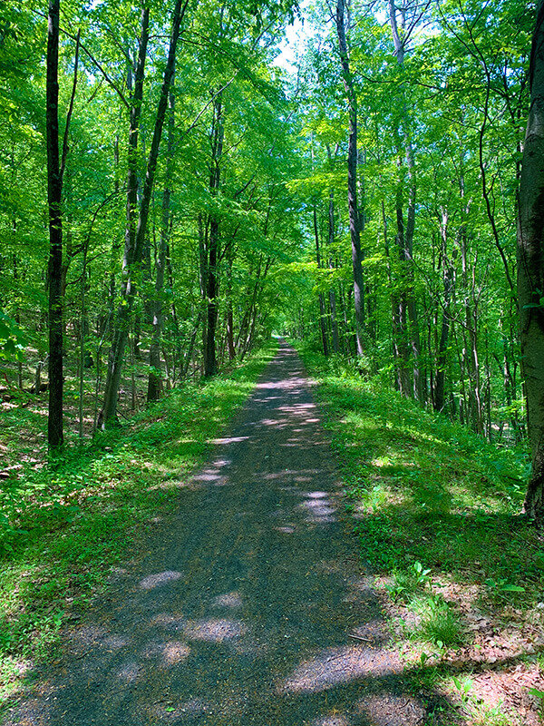
If you usually walk on roads and sidewalks, the Paulinskill Valley Rail Trail is a great option. No cars, no hills, little noise, easy footing, and shade. The Paulinskill Valley Rail trail is that and a lot more.
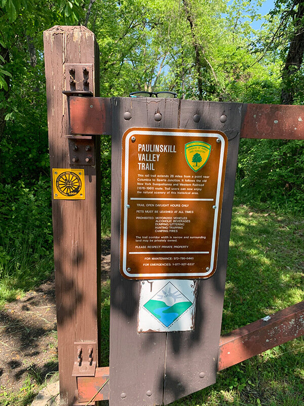
This rail trail is an abandoned rail line with its eastern trailhead located in Lafayette, NJ. It extends for 25.4 miles to its western endpoint in Columbia, NJ, just south of the Delaware Water Gap.

Paulinskill Valley Rail Trail Marker - 70 miles from Jersey City, NJ
An interesting fact is that at one time, this rail line ran from Columbia to its terminus in Jersey City, NJ. All along this route are obelisks with markings such as JC70, meaning you are 70 miles from Jersey City.
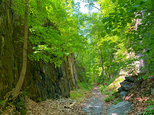
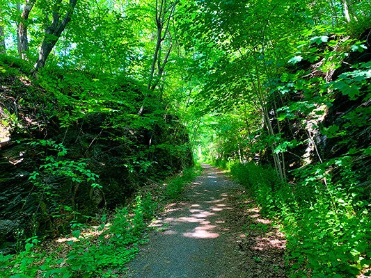
Walking this trail has been one of my best walking/hiking experiences. The trail is wide as it once accommodated locomotives and railroad cars, gradual in elevation gain and descent, and has a smooth walking surface of dirt and gravel in some places.
Rail trails are popular because they have removed the rails and ties, and in their place, left smooth terrain to walk, bike, and ride horseback. There are no boulders, rocks, roots, erosion ruts, or narrow overgrown brush to deal with. Think walking down your local main street with a shade tree canopy instead of tall buildings and storefronts.
This walk was significant for me as I've been nursing sciatic nerve pain that has run down my left leg. The pain was brought on by too much sitting during the winter months as I wrote, recorded, and edited my YouTube Channel content. Finally, I'm healthy and ready to continue my long walks.
There is something about springtime with more sunshine and warm weather that improves my overall health.
Local Knowledge
I started my day at the parking area located on Warbasse Junction Rd. just off of Rt. 94. It was a weekday, and there was only one truck in the lot. As I warmed up my body and prepared my pack for the long day, I met a local hiker as he exited the trail having just walked his dogs.
"Brooklyn" Ray gave me interesting local knowledge of what to see along the trail. "Frank, you have to walk the trail that leads down to the old Hyper Humus Marsh. You'll see so many birds out on the water." Ray showed me on my Alltrails.com app where I can pick up the side trail. Ray moved to the area in 1971 and has seen so much progress, so walking on this rail trail gives him a sense of going back in time.
I started to walk at 8:45 am after spending about 15 minutes talking to Ray. The trail is wide, and it's so easy to walk. I hear birds chirping, and I'm in full shade. It's a beautiful, crisp morning. It's late springtime, so there aren't many bugs, and there is that fragment smell of flowers and marshland. After spending so much time behind a mask due to Covie-19, this is paradise.
Hyper Humus Marshes
I walked a quarter-mile and took a left-hand turn at the trail intersection leading to the Hyper Humus Marsh. This lake was once the home of the Hyper Humus Company. Back in 1979, the company dug up the dirt to sell but always had the game plan of leaving behind this open water and bird sanctuary.

I immediately spotted a goldfinch and a Red-Winged Blackbird flying low along the trail route.
I walked two miles down to the open water of the bird sanctuary and was greeted with the sight of at least two dozen swans and four Blue Heron sharing this ample expanse of water.
Note to self: get a small pair of binoculars and carry them at all times.
I thoroughly enjoyed this unplanned side trip, and that's the beauty of talking to locals.
A great tip is to talk to anyone you meet along the way on a trail. When you come upon a local, I've found they are generally eager to talk about the trail and area. Ray clued me in to the fact that I would probably never find a parking spot on the weekends due to the small size of the lot and that many horse riders with their large trailers occupy the lot.
I made my way back to the Paulinskill trail and began my walk west. My goal was to cover 5 miles out before turning around.
Follow Your Hunch and Take That Side Trail
About two miles from the car, I spotted a makeshift walking bridge that connected an overgrown path to the property behind a big red building. I noticed tables and benches at the side, so I checked the Google Maps app and was pleased to find that the building was Angry Erik Brewery. I was looking forward to the end of this walk and a nice cold beer (disappointment followed, read on)!
The next three miles were a pure joy to walk. Wide trail, no noticeable change in elevation -remember that rail cars need gradual inclines/declines to operate efficiently – and shade, the whole walk other than when the powerlines crossed over the trail is shady. On this hot day, I barely broke a sweat due to the canopy of a wide variety of trees indigenous to North Jersey.
The first two miles from the parking lot, the trail ran parallel to various roads, but once it turned southwest along the Paulinskill, the street sounds disappeared, and there were just birds and quiet time.
At my planned turnaround at Plotts Road, I paused long enough to take a selfie, adjust my pack and begin my 5-mile trek back to my car.
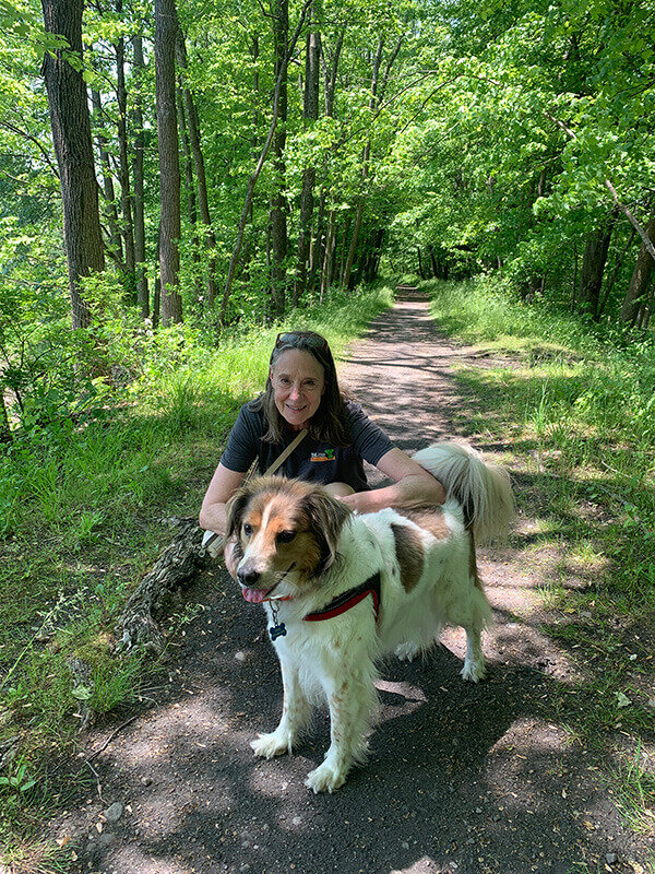
As luck would have it I met up with another local. Karen and her adorable dog Zeeva had just begun walking south for a few miles. We struck up a conversation, and Zeeva liked me and allowed me to pet her, so Karen figured I was "good people."
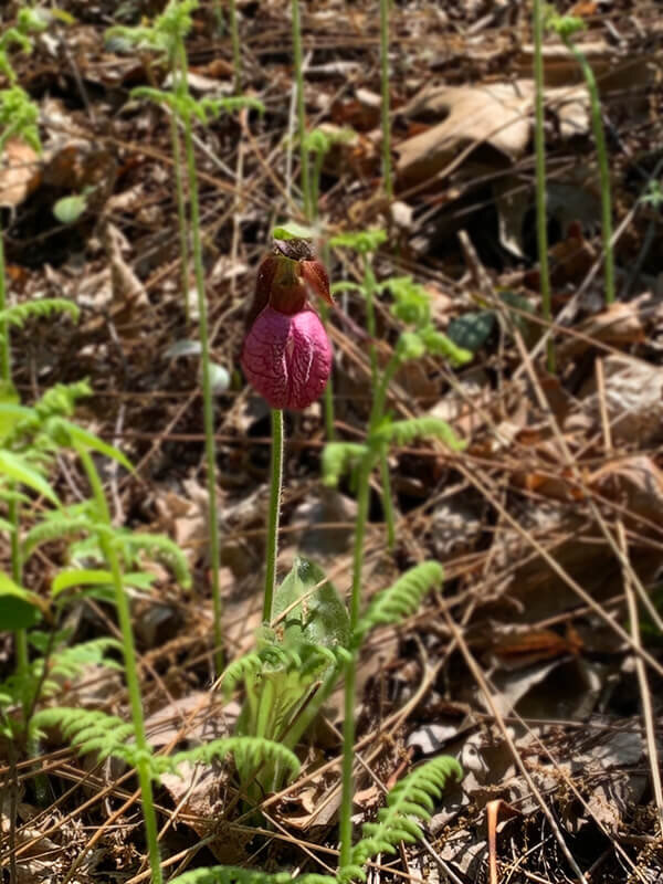
Karen was a wealth of knowledge on local plants and places to eat. She pointed out a rare plant named Indian moccasin or lady slipper and told me it blooms every seven years and only in the exact right soil conditions.
The five miles back to my car was broken up by several stops to take pictures and my side trip to the Brewery.
You Can’t Win Them All!
I made it to Angry Erik Brewery, and to my utter disappointment, it was closed! I peered into the window, shrugged my shoulders, and began to walk back to the trail. As luck would have it, Angry Erik opened the door, and we started talking. I got a brief history of the Brewery and about Erik himself.
Erik is a practicing lawyer and the face and name of the Brewery, while his wife is the brains behind the operation. I told Erik he didn't seem so angry, and in fact, was a nice guy. I'll be back later this summer to enjoy a cold beer.
Back at the car, I did some light stretches and hit to road to find something to eat and a place to write about the day.
Overall, this trail is easily walkable for all fitness levels. This five-mile stretch offered plenty of shade, easy footing, and relatively flat terrain. There were a few places to take pictures, such as the old barn and my side trip to open fields, but the ease of walking the trail made up for the lack of photo opportunities.
I'll be back on the Paulinskill later this spring as I plan to walk it in sections and complete all 25.4 miles of it. I may do it as out and backs each time or, if I can count on finding Uber or other transportation options, I may do a longer one-way walk to complete it.
What I learned on this hike:

This trail is a pleasure to walk so plan a long mileage day here. It’s the the easiest 10 miles I ever covered. I enjoy my own Pleasure Walking Exercise Audio Program during this walk.
I need to carry more water. I began the day slightly dehydrated and felt I was playing catch up with my water intake. Watch: How Much Water Should You Drink Every Day
Keep my battery backup fully charged as my phone quickly ran out of power, and using the backup was necessary.
Create a checklist of items to carry in my pack. I forgot a charging wire and had to return to the car. Luckily, while I was walking back from the bog, I noticed the wire was not on me, so I only had to walk the ¼ mile back to the car from the trail intersection.
Talk to locals! They are eager to share their knowledge of the area. Also use Google maps to find local interests.
My dilemma, how much local knowledge do I reveal? Both Karen and Ray gave me excellent local knowledge on the trail and plants and food options. And, they also told me where locals park on those crowded weekend days. (Hint: While there are not many roadways to cross during this walk, Parking in available at every intersect so check AllTrails at to the route and you’ll find graveled parking area at the side of the road)
Walking in a peaceful place gave my some much time to think, get inspired, and be creative. Download my 40 Inspirational Walking Quotes and jumpstart your creative process!
Part 2 of my Paulinskill Valley Rail Trail adventure is coming soon.
For more information check out Rails-to-Trails Conservancy.
Walk on,
Frank


